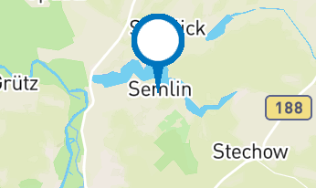
Hohennauen–Ferchesar Lake Circular Trail

Hiking tours
Length: 23 km
0 Ratings of 5 (0)
0
0
0
0
0
How did you like your stay? You have already rated your stay.
Hiking tours
Length: 23 km
From €
Show availability & price

p.P. = pro Person, p.P./N = pro Person / Nacht, p.E./N = pro Einheit/ Nacht, EZ = Einzelzimmer, DZ = Doppelzimmer, FeWo = Holiday flats /home, App. = Appartement, Suite = Suite, FR = Frühstück, HP = Halbpension, VP = VollPension
The long, narrow lake connects the villages of Hohennauen and Ferchesar. With its welcoming hospitality and scenic charm, this area has been a popular destination for those seeking relaxation for more than a century.
Continue readingcollapse
  • Seerundweg Hohennauener-Ferchesarer-See, Foto: Sandra Fonarob , Lizenz: Tourismusverband Havelland e.V.
  • Seerundweg Hohennauener-Ferchesarer-See, Foto: Sandra Fonarob , Lizenz: Tourismusverband Havelland e.V.
  • Seerundweg Hohennauener-Ferchesarer-See, Foto: Sandra Fonarob , Lizenz: Tourismusverband Havelland e.V.
  • Seerundweg Hohennauener-Ferchesarer-See, Foto: Sandra Fonarob, Lizenz: Tourismusverband Havelland e.V.
Leaving Hohennauen, the path crosses the canal bridge. Along the southern shore, the trail follows close to the water or runs beside meadows and fields. In the meadows behind the hamlet of Lötze, you can find botanical rarities such as wild angelica and blue veronica. In Semlin, the path leads along the natural lakeside promenade. A short detour into the village center is well worth it: its picturesque half-timbered church and charming streets are a delight. Also remarkable is the memorial to Anna Ropien, commemorating a local woman who fell victim to the region’s last witch trial in 1672.

As the lake narrows toward its eastern tip, the view opens to the forested panorama on the far shore. This peaceful stretch takes you to the turning point of your tour in Ferchesar, which sits slightly elevated above the lake. A short climb brings you to the village green with its fountain, which is at least 600 years old.

From there, the path continues toward Campingpark Buntspecht, where a welcoming lawn for sunbathing and a small petting zoo await. Always keeping the lake in view, the trail winds through the shade of pine woods on higher terrain. Passing the small settlement of Tegeland, you reach the Ferchesar Forest, where the trees eventually give way to sweeping reed beds of the Hundewiesen. This protected area serves as a haven for rare plants and wildlife, including the bittern, whose deep booming call resonates widely in spring.

Beyond the dyke, the village of Wassersuppe nestles above the lowland meadows. From the narrow pedestrian bridge over the Rhin River, you can already glimpse it. After passing through this uniquely named village, the route takes you along a rural levee path lined with gnarled willows, guiding you back to your starting point.

Tip: Be sure to plan enough time for breaks! The many peaceful lakeside spots with inviting places to swim are simply irresistible – so don’t forget your towel.

Trail Information

  • Waymarking: Red bar on a white background and “Seerundweg” signs

  • Start/Finish: Village green in Seeblick, district of Hohennauen

  • Length/Duration: 23.2 km / approx. 6 hours

  • Suitable for: Experienced hikers

  • Parking: According to local regulations on-site

  • Public transport: Bus stop “Hohennauen/Dorf,” lines 684, 685, 687

Continue readingcollapse

Arrival planner

Am Dorfanger

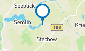
14728 Seeblick OT Hohennauen

Weather Today, 20. 5.

12 19
broken clouds

  • Thursday
    9 20
  • Friday
    10 22

Holiday region

Tourismusverband Havelland e.V.

Theodor-Fontane-Straße 10
14641 Nauen OT Ribbeck

Tel.: +49 (0) 33237-859030
Fax: +49 (0) 33237-859040

Weather Today, 20. 5.

12 19
broken clouds

  • Thursday
    9 20
  • Friday
    10 22

Alle Informationen, Zeiten und Preise werden regelmäßig geprüft und aktualisiert. Trotzdem können wir für die Richtigkeit der Daten keine Gewähr übernehmen. Wir empfehlen Ihnen, vor Ihrem Besuch telefonisch / per E-Mail oder über die Internetseiten des Anbieters den aktuellen Stand zu erfragen.